Surveying in Nunavut: Challenge Accepted

Surveying in Nunavut: Challenge Accepted

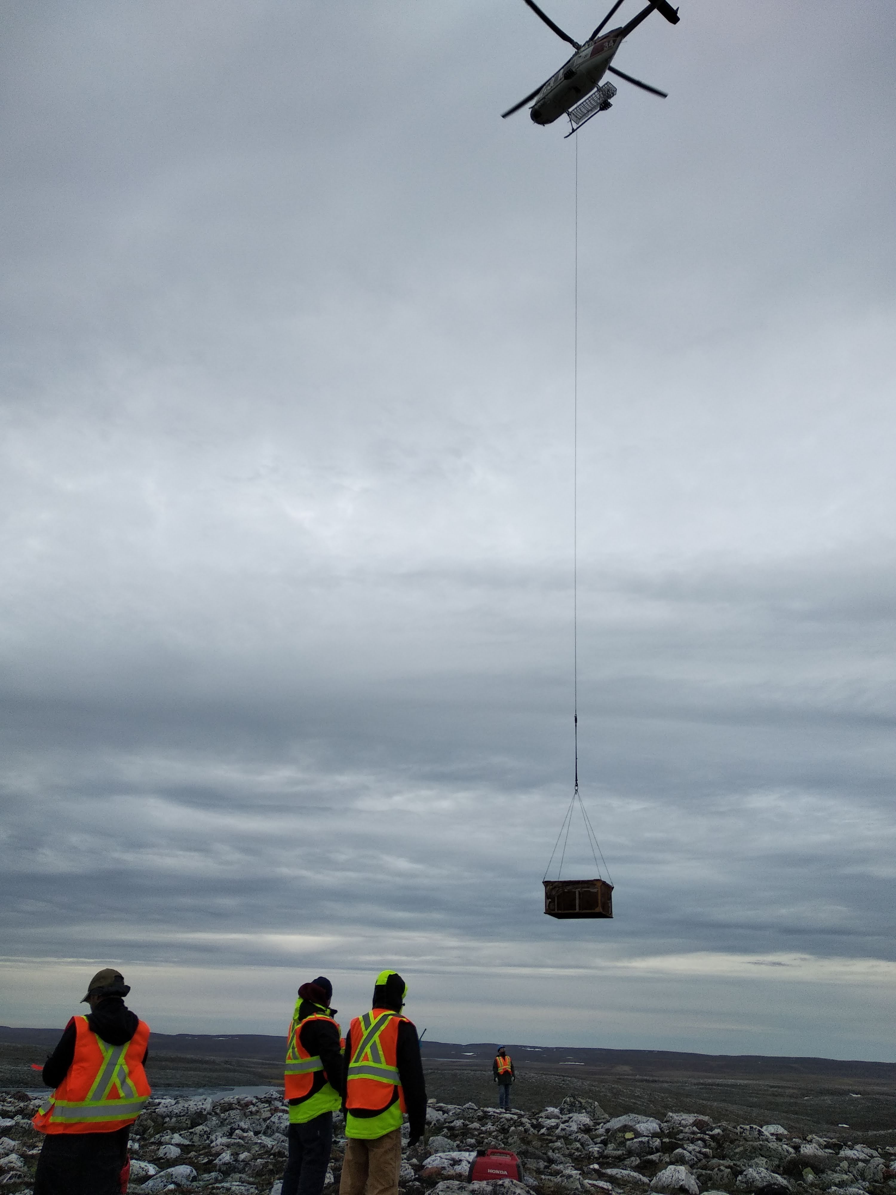
Surveying within the Territory of Nunavut isn’t exactly a walk in the park. DEVBRIO and Vision 4K teamed up to succeed and achieve what many have failed to do, but it wasn’t without a few difficulties along the way.

The collaborating partners were assigned a low altitude magnetic survey, yielding 900 kilometers of good quality data which was delivered to senior Canadian gold mining company Agnico Eagle Mines using our tool of choice: The Drone Magnetometer Survey System. Throughout the project, many obstacles were met such as unfavorable weather, some logistic issues and operating via visual line of sight (VLOS).

Unfavorable weather

Being located directly in the Canadian Arctic Tundra, the field crew has had their fair share of extreme weather conditions like gusty winds, high constant winds, thick fog and unreliable weather forecasts. Flying a drone carrying a load makes it particularly tricky to counteract the effects of these factors, so a line must be drawn when the conditions are too risky for production. Furthermore, the fact that the weather forecasts themselves were highly erratic made it difficult to anticipate adequate data acquisition conditions, which would sometimes create unwanted delays in such a project.

Logistic Issues

The most important logistic issue was transportation of the crew members and their equipment. That being said, the survey grid was located in a remote area where it was only accessible by helicopter. Every morning, the team would go on board and the gear would be slung with a long line to the surveying area, then back to camp at the end of the day. The coordination and collaboration between the field crew and the helicopter pilot was crucial when important decisions had to be made regarding the flying conditions.

Visual line of sight

The name says it all. When operating an unmanned aerial vehicle, the pilot must visually see the drone at all times when it is airborne and this is a matter of safety. In order to maintain a secure data acquisition procedure, the pilot focuses solely on the drone while a fellow team member monitors all the data via the telemetry software. To add to this, the drones are equipped with powerful LED strobe lights that are capable of turning night into day.

Why not another helicopter survey?

It’s a matter of spatial resolution. The combination of the lower acquisition speed, very strict altitude and trajectory control (GPS RTK) and low flying altitude just can’t be matched safely by a helicopter.

Leave a Comment

Your email address will not be published. Required fields are marked *